

Mt.Oakan
For climbers
Mt. Oakan takes about 6 hours to reach the summit and back, more time than Mt.Meakan.
Please allow plenty of time and bring sufficient equipment.
Mt.Oakan Trail
Distance:approx. 6.7km(one-way)
time:[Ascent]3hr20min
[Descent]2hr20min
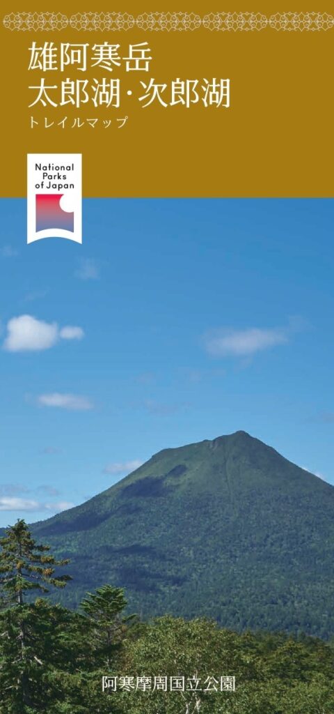
Located 1,370 meters above sea level on the east side of Lake Akan, Mt. Oakan is called “Pinesiri (mountain of men)” in Ainu language.
The trail starts at the “Takiguchi” . From the fifth station, the view opens up to Mt.Meakan and Lake Akan. On clear days, the normally inaccessible lakes 「Lake Penketo」 and 「Lake Panketo」, as well as the mountains of Shiretoko in the distance, can be seen from the summit. The trail is steep and long, but the view from the summit is spectacular.

Lake Taro・Lake Jiro
Follow the Mt. Oakan Trail along the river flowing out of the sluice gate on the opposite side of the 「Takiguchi」 for about 500 meters, and you will see 「Lake Taro」 on your right. Water from Lake Akan flows into Lake Taro and,Lake Taro is home to freshwater fish.
About 700 meters down on the left from 「Lake Taro」 is 「Lake Jiro」. Compared to 「Lake Taro」, 「Lake Jiro」 is surrounded by dense forest and is very quiet. Both lakes are not far from 「Takiguchi」. They are accessible only on foot.

アクセス情報
Akankohan Visitor Center → National Route 240 (5 minutes by car) → Mt.Oakan trailhead